Horseshoe Bay Wilderness
Horseshoe Bay curves gently along the northwest shore of Lake Huron. Sandy beaches line the southern third of the shoreline, transitioning to rocky and marshy areas in the north. As you hike in, you’ll encounter low ridges covered with balsam and cedar, which separate narrow, shallow swamps. Remnants of past logging operations—abandoned roads and cedar stumps—can still be seen here. Long before the loggers arrived, evidence suggests that Native Americans fished these waters along Lake Huron’s shores. This Wilderness borders include areas of private land, and the wildlife reflects typical wetland species.
Description from Wilderness Connect (wilderness.net).
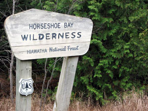
| Designation | Wilderness |
| Managed by | U.S. Forest Service |
| State | Michigan |
| Size | 3,879 acres |
| Designated | 1987, by Congress |
| Center point | 45.98° N, 84.72° W |
| Night sky | About as dark as the ground gets (Black Marble reading 9) |
Boundary map
Boundary, simplified to about 0.005 degrees Federal campground
The outline is the agency boundary simplified for display, so small parcels and inholdings may not show. The agency page has the authoritative map.
Weather by month
Large units span more than one climate. The station stands in for the center point, and the outer parts of the boundary can be warmer or colder.
Where to camp
None of the 1 federal campground within ten miles sits inside the boundary. Nearest first. Distances are from the campground point to the boundary edge, from the Campsite Atlas index.
Trails
1 named Forest Service trail enters this wilderness, 1 mile in all.
| Trail | Miles | Allowed uses |
|---|---|---|
| Horseshoe Bay | 1.1 |
Lengths and allowed uses come from the Forest Service trail layer by way of Trailhead Atlas. This trail list was copied from Trailhead Atlas on November 1, 2026 and is copied again on each weekly run. Trails in plain text have no page there yet.
Fire nearby
- PrescribedPaula Red South Rx
27 mi from the center point · 147 acres
- PrescribedRed Delicious Rx
30 mi from the center point · 289 acres
Distance is to the reported incident point, not the fire edge, and is measured from the center of a boundary that may be many miles across. Check the agency page for closures.
Explore
Nearby on the other atlases
- 4.3 miSt. Ignace Mission ↗National Historic Landmark
- 8.9 miGrand Hotel ↗National Historic Landmark
- 1 miMackinac Trail--Carp River Bridge ↗St. Ignace Township, MI
- 4.6 miChambers, John, House ↗St. Ignace, MI
- 5 miGros Cap Cemetery ↗Gros Cap, MI
- 5.8 miSacred Heart-Gros Cap Church ↗Moran Township, MI
- 7.8 miSt. Helena Island Light Station ↗St. Ignace, MI
- 8.9 miYoung, Lawrence Andrew, Cottage ↗Mackinac Island, MI
Landmarks are listed first, then by distance from the boundary.
Guidebooks for Michigan
We earn a small commission if you buy through these links. It does not change what we list.
- Explorer's Guide 50 Hikes on and Around the North Country Trail - Michigan and WisconsinThomas Funke, 2016Find at Bookshop.org
Titles come from Open Library's catalog, matched by subject heading or by title.
Reference
Questions people ask
How big is Horseshoe Bay Wilderness?
3,879 acres.
Source: Wilderness Connect
Who manages Horseshoe Bay Wilderness?
The U.S. Forest Service.
Source: Wilderness Connect
What state is Horseshoe Bay Wilderness in?
Michigan.
Source: Wilderness Connect
When was Horseshoe Bay Wilderness designated?
Congress designated it in 1987.
Source: Wilderness Connect
Can I camp at Horseshoe Bay Wilderness?
Camping inside a wilderness is usually allowed away from roads, with no facilities, and the managing agency page has the permit rules. The federal campgrounds within ten miles are listed under Where to camp.
Source: Where to camp
How do I get to Horseshoe Bay Wilderness?
A point inside the boundary is at 45.975° N, 84.719° W. The official page carries directions and the office address.
Source: Wilderness Connect
Is there a fire near Horseshoe Bay Wilderness right now?
2 active incidents within 50 miles as of 2026-11-01, the nearest Paula Red South Rx at 27 miles. Distance is to the reported incident point, not the fire edge.
Source: Fire nearby
Are there historic places near Horseshoe Bay Wilderness?
The National Register has 19 listings within 15 miles, including St. Ignace Mission and Grand Hotel.
Source: Register Atlas
Sources
- Boundary, name, acreage, designation year, states and description: Wilderness Connect.
- Campgrounds: the Campsite Atlas index of federal campgrounds, matched to this boundary at build time.
- Trailheads and sites: the Forest Service Recreation Opportunities layer, points inside the boundary.
- Trails: the Trailhead Atlas open-data file of Forest Service trails, matched on the wilderness each trail enters.
- Night sky: NASA Black Marble (VIIRS, 2016 composite) sampled at zoom 6 around the center point.
- Weather, alerts, air quality, river flow and earthquakes load live in your browser from NWS, AirNow, USGS and iNaturalist when you open the page.