Rocky Mountain National Park Wilderness
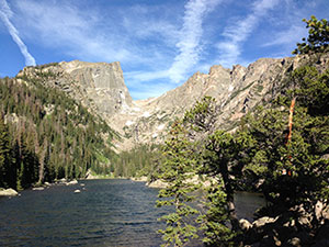
Following its initial recommendation for wilderness protection, the stunning wild lands of Rocky Mountain National Park Wilderness sat in limbo for 35 years before finally being designated. This living showcase of the grandeur of the Rocky Mountains, with elevations ranging from 7,860 feet in the wet, grassy valleys to 14,259 feet at the weather-ravaged top of Longs Peak, provides visitors from around the world with countless opportunities for breathtaking experiences and adventures. The Continental Divide runs northwest to southeast through the center of the Wilderness atop the high peaks. Over one-third of the Wilderness is above treeline with more than sixty peaks over 12,000 feet.
Description from Wilderness Connect (wilderness.net).
| Designation | Wilderness |
| Managed by | National Park Service |
| State | Colorado |
| Size | 249,126 acres |
| Designated | 2009, by Congress |
| Center point | 40.36° N, 105.70° W |
| Night sky | Very dark ground, a faint glow at most (Black Marble reading 20) |
Boundary map
Boundary, simplified to about 0.005 degrees Federal campground
The outline is the agency boundary simplified for display, so small parcels and inholdings may not show. The agency page has the authoritative map.
Weather by month
Large units span more than one climate. The station stands in for the center point, and the outer parts of the boundary can be warmer or colder.
Where to camp
1 federal campground sits inside the boundary and 22 more are within ten miles of it. Nearest first. Distances are from the campground point to the boundary edge, from the Campsite Atlas index.
Show 4 moreHide
11 more within ten miles are not listed here.
Trails
11 named Forest Service trails enter this wilderness, 41 miles in all. The 10 longest are listed here.
| Trail | Miles | Allowed uses |
|---|---|---|
| Bowen Gulch ↗ | 7.8 | |
| Baker Gulch ↗ | 6.1 | |
| Mirror Lake ↗ | 4.6 | |
| North Fork ↗ | 4.5 | |
| South Signal Mountain | 4 | |
| Mummy Pass | 3.5 | |
| Stormy Peaks | 3.2 | |
| West Creek | 2.6 | |
| North Boundary | 2.5 | |
| Twin Sisters Peaks | 1.7 |
Lengths and allowed uses come from the Forest Service trail layer by way of Trailhead Atlas. This trail list was copied from Trailhead Atlas on November 1, 2026 and is copied again on each weekly run. Trails in plain text have no page there yet.
Fire nearby
- PrescribedFront Country Broadcast Rx
7 mi from the center point
- PrescribedSalt Cabin Broadcast Rx
23 mi from the center point
- PrescribedMagic Feather Broadcast Rx
28 mi from the center point
Distance is to the reported incident point, not the fire edge, and is measured from the center of a boundary that may be many miles across. Check the agency page for closures.
Explore
Nearby on the other atlases
- 1.6 miRocky Mountain National Park Administration Building ↗National Historic Landmark
- under 0.1 miBear Lake Comfort Station ↗Estes Park, CO
- under 0.1 miFern Lake Patrol Cabin ↗Estes Park, CO
- under 0.1 miShadow Mountain Lookout ↗Grand Lake, CO
- under 0.1 miThunder Lake Patrol Cabin ↗Estes Park, CO
- under 0.1 miTwin Sisters Lookout ↗Estes Park, CO
- under 0.1 miVaille, Agnes, Shelter ↗Estes Park, CO
- under 0.1 miWild Basin House ↗Estes Park, CO
Landmarks are listed first, then by distance from the boundary.
Guidebooks for Colorado
We earn a small commission if you buy through these links. It does not change what we list.
Titles come from Open Library's catalog, matched by subject heading or by title.
Reference
Questions people ask
How big is Rocky Mountain National Park Wilderness?
249,126 acres.
Source: Wilderness Connect
Who manages Rocky Mountain National Park Wilderness?
The National Park Service.
Source: Wilderness Connect
What state is Rocky Mountain National Park Wilderness in?
Colorado.
Source: Wilderness Connect
When was Rocky Mountain National Park Wilderness designated?
Congress designated it in 2009.
Source: Wilderness Connect
Can I camp at Rocky Mountain National Park Wilderness?
Camping inside a wilderness is usually allowed away from roads, with no facilities, and the managing agency page has the permit rules. The federal campgrounds within ten miles are listed under Where to camp.
Source: Where to camp
How do I get to Rocky Mountain National Park Wilderness?
A point inside the boundary is at 40.357° N, 105.701° W. Rocky Mountain National Park is adjacent. The official page carries directions and the office address.
Source: Wilderness Connect
Is there a fire near Rocky Mountain National Park Wilderness right now?
3 active incidents within 50 miles as of 2026-11-01, the nearest Front Country Broadcast Rx at 7 miles. Distance is to the reported incident point, not the fire edge.
Source: Fire nearby
Which national parks are near Rocky Mountain National Park Wilderness?
Rocky Mountain National Park (adjacent). Park Atlas has fees, hours and alerts for each.
Source: Nearby on the other atlases
Are there historic places near Rocky Mountain National Park Wilderness?
The National Register has 60 listings within 15 miles, including Rocky Mountain National Park Administration Building and Bear Lake Comfort Station.
Source: Register Atlas
Sources
- Boundary, name, acreage, designation year, states and description: Wilderness Connect.
- Campgrounds: the Campsite Atlas index of federal campgrounds, matched to this boundary at build time.
- Trailheads and sites: the Forest Service Recreation Opportunities layer, points inside the boundary.
- Trails: the Trailhead Atlas open-data file of Forest Service trails, matched on the wilderness each trail enters.
- Night sky: NASA Black Marble (VIIRS, 2016 composite) sampled at zoom 6 around the center point.
- Weather, alerts, air quality, river flow and earthquakes load live in your browser from NWS, AirNow, USGS and iNaturalist when you open the page.